cruxle.org - collaborative climbing topos
cruxle.org is a database for climbing metadata and climbing topos presented as overlays on zoomable wall photographs.
It is the wikipedia idea applied to topos and climbing information. Everything can be edited by everyone - no paywalls. You can contribute by uploading new topos or adding routes and descriptions to existing ones.
The full software stack is opensource and available under the GNU Affero GPL at: https://gitlab.com/cruxle/cruxle Contributions are welcome!
All pictures and routes are created by members of the cruxle.org community
and get published under the Creative Commons License
to ensure that the work you put in is free to use for everyone and will stay free in the future.
Join your fellow cruxlers and help to provide the best topo guides to the climbing community!
Your cruxle.org team
Fabi, Al and Jonas
Support Us
cruxle.org is free of charge, but running our infrastructure isn't. If you want to help us out, use the following account:
mitopo.UG
IBAN / BIC:
DE16 7015 0000 1004 9803 12 / SSKMDEMMXXX
History
The idea for cruxle was born 2015 in the evening after a long climbing tour out of frustration about the quality of commercial topos.
A vision emerged: Easy creation and editing functionalities provided to a lively community should be the key ingredients for up-to-date topos, decreasing climbers frustration and increasing their safety. The wikipedia idea applied to topos and climbing information.
Developing the project only on our free time, it took us about three years to finally move it online. So in 2018, we present cruxle.org, a platform for sharing climbing topos.
Credits
Over the years there have been so many people who contributed to the success of this page that it seems impossible to name all of you.
A special thanks goes to Adrian Jaeschke for his contributions to the page design.
Last but not least, we would like to express our special gratitude to the relentless input and testing of
-
Berni, Albert & Hannah, Knalltöle, Hans, Diana, Tobi, Christina!
This website makes extensive use of the following opensource projects:
- Django - is a high-level Python Web framework.
- OpenStreetMap - has by far the most up to date informations on local paths and pretty much about anything. A testiment that collaborative community projects can thrive!
- Bootstrap - popular front-end framework for responsive, mobile first projects.
- leaflet - for interactive maps and we also use it navigate giga pixel panoramas
- Leaflet.Markercluster - Marker Clustering plugin for Leaflet. Good if you want to show a lot of markers on a map.
- And some more libraries: Jquery, Datatables, Nvd3, Leaflet.Locatecontrol, Leaflet.EasyButton, Croppie, montserrat-webfont
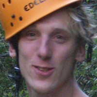
« I moved to Berlin and since then I mostly go Bouldering indoors. What I miss most about climbing actual mountains is the opportunity to wear my collection of fancy fashionable helmets. At least I can remember the good ol' days with my pictures from cruxle.org. »

« I like to hike and watch the walls from a safe distance ;). For me, the great thing about cruxle.org is that I can fully contribute my skillset as a software engineer and system administrator and I leave the climbing to my fellow cruxlers. »
« I love to climb moderate but long trad routes. Otherwise I am trying to learn more about the weather and clouds (Meteorologist). One distinct feature I like a lot about the project is the panorama stitcher which allows me to create stunning high resolution images with low-end camera gear. »